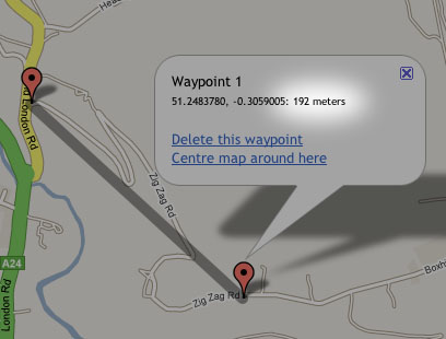
Well, lots of people have asked for it, so I’m looking to add elevation data (i.e. altitude) to the route planner*. I’ve got it storing the figure for each waypoint in my test version of the application. I’m now wondering what to do with it! At present I’m thinking maybe just have the ability to display a ride profile with total number of meters climbed etc.
If anyone’s got any ideas on what they’d like to see implemented regarding this, now’s the time to speak up.
*Edit: to clarify, I mean the route planner will determine the elevation of each of your waypoints when you are planning the route, not simply read the data from a route that the GPS unit has recorded.
BTW… Safari users will be pleased to hear that the “click through” bug on the markers’ popups will be cured in the next release too. Turns out to be an obscure problem between the GMaps API and Safari (i.e. not my code!) that I had to work around…
Hi Martyn – I like the software now I have eventually got my 205 and it talking to each other. Some comments and questions on my experiences to date.
1. As far as I can see GPSBabel sucks down everything in the 205 memory so unless one wants to go editing the gpx file (which I had to do but don’t want to make a habit of it) you have to do a full delete before capturing new data. Am I right or have I missed something?
2. If I am right what options are there to accumulate data for multi-day use if you are not carrying your computer? I was thinking of getting a complete record of a 6 day walk on the Cotswold Way in a couple of weeks time and I don’t want to take my Mac with me.
3. Altitude data would be good. A height-distance profile plus height gained, height lost and net height gained summary would be what I would look for, although from a quick look at the data coming off GPSBabel there looks to be a lot of noise so the profile from a filtered dataset might be of limited value.
Keep up the good work – its great to have something useable and Mac able.
Andrew
Martyn – I think it would be great if you could add elevation data to the Marengo Route Planner.
I see that Google Maps have now added a “Terrain” view – any chance of updating the Route Planner to give this as an option?? It would be a great way to avoid surprise hills….
Cheers
Rob